Thomas Fire now 4th largest wildfire in California history; new evacuations ordered


SANTA BARBARA, Calif. (KABC) -- As the Thomas Fire continues to grow and threaten communities, the destructive blaze is now considered the fourth largest wildfire in California history.
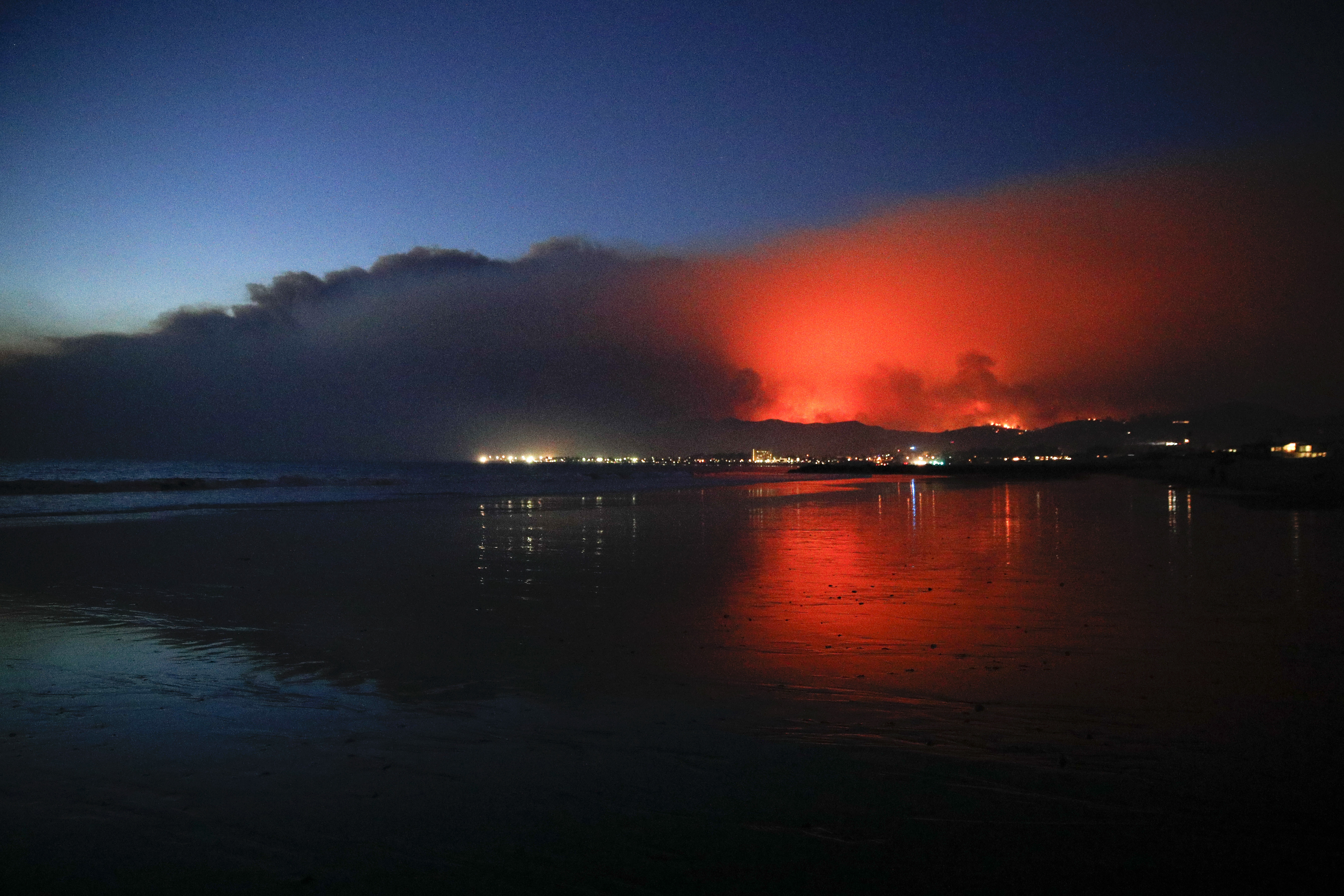
According to Cal Fire, the Thomas Fire has scorched 249,500 acres, which amounts to about 390 square miles. The fire has covered more ground than the city of San Diego.
The colossal blaze, which straddles coastal Ventura and Santa Barbara counties, was 35 percent contained as of Thursday evening.
RELATED: Firefighter killed while battling Thomas Fire
Since the inferno erupted in Santa Paula on Dec. 4, the blaze has destroyed 974 structures, damaged 258 others and threatens 18,000 more.
VIDEO: Aerial footage shows before-and-after look at destruction from Thomas Fire

Firefighters say the blaze is continuing its destructive path into Santa Barbara County, threatening the communities of Carpinteria, Summerland, Montecito and surrounding areas.
Gusty conditions will keep the red flag warning in effect in the firezone through Friday morning.
MORE: Latest Southern California forecast
Fire officials said crews will focus most of their resources on securing the western side of the blaze above the coastal communities in Santa Barbara County.
Firefighters are also remaining very active in Ventura County, where crews are continuing to suppress active and small spot fires around the southeastern portion of the fire's perimeter.
In the Fillmore area, mandatory evacuations were ordered for the following areas: Sespe Creek to the west, Burson Ranch to the east, the Los Padres National Forest boundary to the north and the Fillmore city limits to the south.
An evacuation advisory was given for the following areas: The areas from 2nd Street north on Island View Street, west on 4th Street to A Street, north to Goodenough Road and north to Levee.
Fire crews made some progress Wednesday on corralling the fire, which continued to spread mostly into national forest land. Calmer conditions have allowed firefighters to make a steady attack with water-dropping helicopters. The expected forecast, however, is forcing residents to remain on guard.
"Of course that's a concern, but specifically, I think the fire front has moved off where our particular house is," a Montecito resident shared.
Residents were also warning of looters that have been spotted in firezones. One person dressed as a Red Cross worker -- something most Red Cross employees don't do -- was even going door-to-door, warning homeowners of evacuations. Officials say that is normally a job that a sheriff's department would handle.
PHOTOS: Thomas Fire devastates Ventura County


The cause of the blaze is under investigation. Southern California Edison said state officials are investigating whether the utility's equipment played a role in sparking any of the wildfires that have burned in Southern California in recent days.
ABC7 has decided to remove the comments section from stories. We believe very strongly that our audience should have an opportunity to discuss and debate events in our world; however, we have not been able to moderate the comments as well as we would like. Instead of hosting a platform that could allow a few loud and ugly voices to dominate a conversation, we want to encourage everyone to join us on our social media platforms and speak out there.
Facebook: facebook.com/abc7
Twitter: twitter.com/abc7


