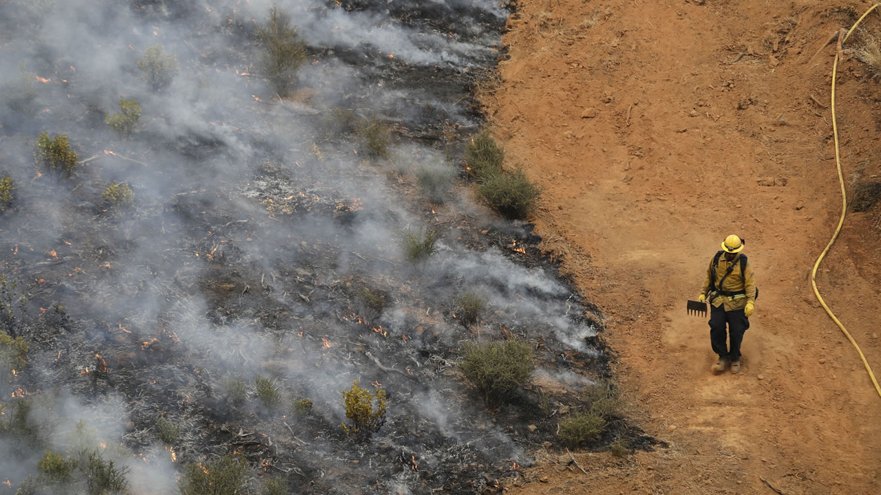
Carr Fire burning in Northern California's Shasta County grows to 103,772 acres; 23 percent contained


REDDING, Calif. -- The Carr Fire burning in Shasta County grew to 103,772 acres and was 23 percent contained by Monday evening. Nearly 40,000 people have been evacuated due to the devastating fire.
One of the more badly damaged areas has been the Mary Lake subdivision. Police are still concerned about hot spots and live gas lines. Many homeowners have been turned away.
VIDEO: Drive through Carr Fire near Redding reveals apocalyptic scenes

Out of the devastation, there have been stories of resilience -- a sheriff's deputy lost his home early Thursday but has continued to serve his community, helping with the evacuations.
MORE: 2 young children, great-grandmother killed in massive Carr Fire

A sixth life was claimed by the fires over the weekend. The sheriff said the man who died refused to evacuate his home. Authorities say by not evacuating, you're not only putting your own life, but the lives of first responders on the line.
Last week, Ed Bledsoe said he did not know his home was in danger when he left his wife, Melody, and his 4- and 5-year-old grandchildren to run an errand.
"If I'd have any kind of warning, I'd have never, ever left my family in that house," Bledsoe said.
Bledsoe received a phone call from his wife 15 minutes after he left imploring him to get home because the fire was approaching.
He said one of the children told him the blaze was at the back door. When he tried to return, the road was blocked and flames prevented him from returning on foot.
Shasta County Sheriff Tom Bosenko said there's an investigation into whether the Bledsoe home received a warning call or a knock on the door. The sheriff said there is evidence that door-to-door notifications were made in the area.
Nineteen reports of missing people remained outstanding as of Monday evening, according to Bosenko.
Crews handling the blaze near Redding struck a hopeful tone for the first time in days as the massive fire slowed after days of rapid expansion. As of Monday, the Redding fire had destroyed 723 homes.
"We're feeling a lot more optimistic today as we're starting to gain some ground rather than being in a defensive mode on this fire all the time," California Department of Forestry and Fire Protection's incident commander Bret Gouvea said.
VIDEO: What it's like to fly over the Carr Fire in a California National Guard plane

PHOTOS: Apocalyptic Carr Fire burns through Shasta County


MANDATORY EVACUATIONS
- Ashby Road & Lake Blvd
- Beltline at Oasis
- Benton & Quartz Hill Road
- Buckhorn Summit at SR 299 (Eastbound) Buenaventura at Keswick
- Buenventura & Hwy 299
- Caterpillar at Market
- Clear Creek Road & Cloverdale Lane Hwy 299 at Buckhorn Summit
- Elk Dr at Carnelian
- Eureka Way at Court Street
- Gas Point at Clear Creek Rd
- Gas Point Road and Foster Road
- Happy Valley Trail and Hawthorn Road
- Hwy 299 at Buckhorn Summit
- Iron Mountain Rd at SR 299
- Keswick Dam Boulevard at Keswick Dam Facility
- Keswick Dam Road & Quartz Hill Road
- Lake at Keswick
- Lake at Oasis
- Lake at Quartz Hill
- Lower Springs Rd at Swasey Drive
- Market at Lake
- North Market South of Lake
- North Point at Redwood
- Oasis Road & Lake Blvd
- Placer at Buenaventura
- Placer at Mule Town
- Plantina Road and Rainbow Lake Road Plantina Road and Placer Road Planting Road & Gas Point Road Railroad at Buenaventura
- Ridge Lane at SR 299
- Riviera at Howard
- SR 299 from Buenaventura Boulevard to Buckhorn Summit
- SR-273 at Bonnyville
- SR-273 at Branstetter
- SR-273 at Breslauer
- SR-273 at Clear Creek
- SR-273 at Kenyon
- SR-273 at Westside Rd
- Sway Drive & Placer Road
- Texas Springs at Placer
- Texas Springs Road & Honeybee Road
EVACUATION SHELTERS
- Crosspointe Community Church - 2960 Hartnell Avenue, Redding, CA, 96002
- Simpson University - 2211 College View Dr, Redding, CA, 96003
- Trinity High School - 321 Victory Lane, Weaverville, CA, 96093
- Foothill High School - 11555 Old Oregon Trail, Redding, CA, 96003
Shasta Community College has reached its maximum capacity.
ANIMAL SHELTERS
- Large Animal - Redding Rodeo Grounds 715 Auditorium Drive Redding, Ca.
- Small Animal - Haven Humane 9417 East Side Drive Redding, Ca.
Click here for the latest information from Cal Fire on the incident, including updated evacuation information.
Get the latest on the Carr Fire here and the latest on wildfires across California here.
The Associated Press contributed to this report.


