Coronavirus map: Here's where COVID-19 has spread in the United States


LOS ANGELES (KABC) -- Cases of the coronavirus have emerged across the country, including Southern California and the surrounding region.
President Donald Trump has officially declared a national emergency due to the coronavirus, and we're seeing a direct impact here in Southern California, the LAUSD announcing that it is shutting down all of its schools in response to the pandemic.
Other school districts all over Southern California are now following suit, as the number of coronavirus infections continues to climb in L.A. County along with the possibility that some of the new cases were transmitted in the community. In a dramatic response to the virus outbreak, the archdiocese of Los Angeles urged worshippers not to attend Sunday mass - right in the middle of Lent.
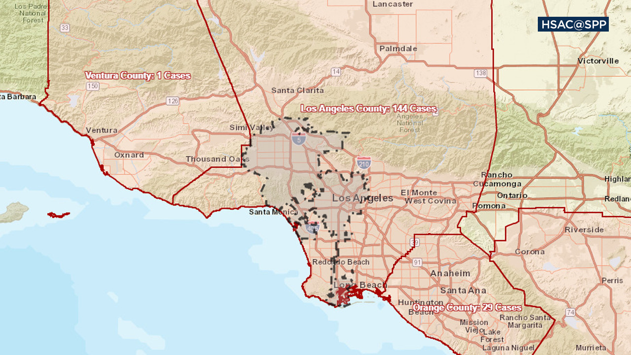
As the way of life changes by the day, here's a look at where COVID-19 cases have appeared:
*Use the tabs to choose to see a map or totals by country and state. Clicking on the U.S. inside the map will show the latest available numbers by county across the country.