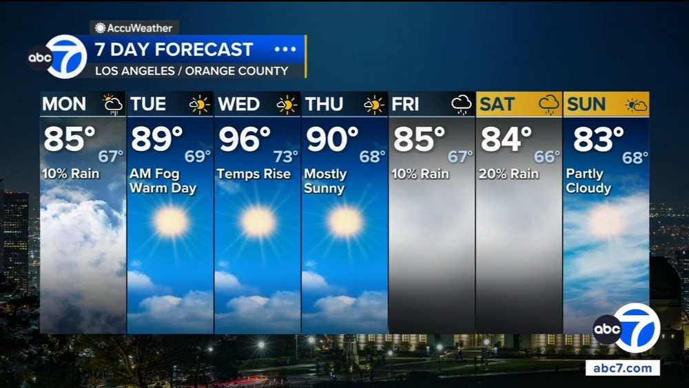
NASA satellite imagery shows 1,214-mile smoke plume from California wildfires


SAN FRANCISCO -- The 560 wildfires that have scorched California this week have created a 1,214-mile smoke plume visible from space, new NASA imagery shows.
The space agency on Thursday released photos from its Terra satellite showing smoke stretching northeast from the Pacific Ocean off mid-Baja California, Mexico, to Pocatello, Idaho.
Officials said Friday that 771,000 acres had burned in California since Aug. 15, an area collectively larger than the state of Rhode Island, after the state was hammered by more than 12,000 lightning strikes. Many of the fires around the state are contained, though the LNU, SCU and CZU Lightning Complex fires have collectively burned 500,000 acres in all but one Bay Area county.
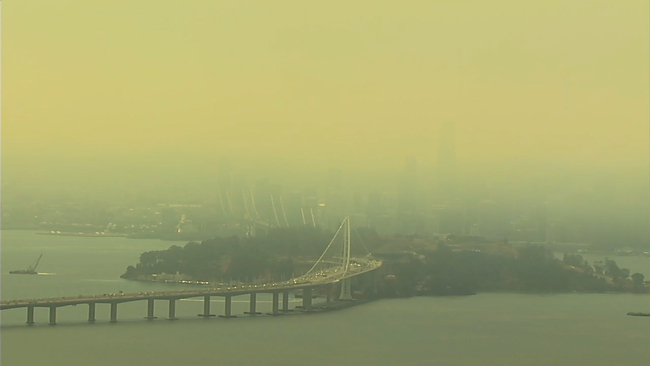
RELATED: Bay Area air quality worst in the world as wildfires rage in all but one county
Statewide, nearly 12,000 firefighters are battling blazes, said Daniel Berlant, assistant deputy director for CAL FIRE. Crews from Oregon, Idaho and Arizona have arrived to relieve local firefighters, he said, with engines on their way from as far away as Maryland and New Jersey.
Get the latest updates and videos on wildfires burning across California here.
INTERACTIVE: California Wildfire Tracker
App users: For a better experience, click here to view the full map in a new window
RELATED STORIES & VIDEOS:
- Here are all the fires burning in the Bay Area right now
- Track air quality levels in the Bay Area
- Bay Area air quality worst in the world as wildfires rage in all but one county
- Most destructive California wildfires in history
- How are wildfires started? A look at the causes of some of the worst in California history
- The difference between containing and controlling a wildfire
- How wildfire smoke can impact your health
- What's in wildfire smoke? How it can impact your health
The Associated Press contributed to this report.