Blue Ridge Fire evacuation map for Orange and San Bernadino County


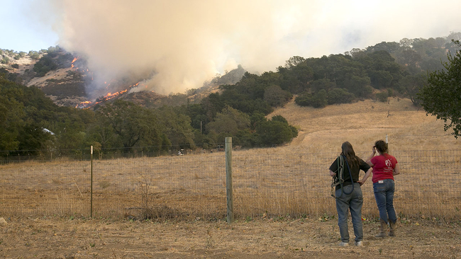
YORBA LINDA, Calif. (KABC) -- A brush fire that rapidly spread is threatening homes, triggering thousands of mandatory evacuations in Yorba Linda, Chino Hills and Brea.
See below for a map of evacuation zones and get the latest updates on the Blue Ridge Fire here.
Blue Ridge Fire evacuation map
Please note the map may take some time to load. The map can also be seen at this link.
ORANGE COUNTY
SAN BERNADINO COUNTY
Evacuation orders were issued for Yorba Linda neighborhoods north of the 91 Freeway, east of Gypsum Canyon including Bryant Ranch Elementary school, according to the Orange County Sheriff's Department.
The Hidden Hills neighborhood of Yorba Linda was also added to the evacuations.
"Anyone in the affected area should evacuate immediately," the OCSD tweeted.
At 10 a.m. Wednesday morning, the evacuation warning for the southern portion of Diamond bar was lifted.
RELATED | What to prepare in case of a wildfire evacuation
The sheriff's department estimated about 4,000 properties, with 10,000 people, were evacuated in Yorba Linda, but OCFA officials did not say how many homes were under mandatory evacuation.
The Brea Police Department alerted residents at about 9 p.m. to a mandatory evacuation order for people in the areas of Hollydale and Olinda Village in Carbon Canyon. Residents are asked to leave westbound on Carbon Canyon. A voluntary order was in place for the communities of Brea Hills and Olinda Ranch.
Download the ABC7 Los Angeles app on your iPhone or Android device and opt into push notifications to get the latest updates on the Blue Ridge Fire.
Chino Valley Fire officials Monday night issued a mandatory evacuation for all of Carbon Canyon, from the county line to Summit Ranch on both the west and east sides of Carbon Canyon Road. The area includes Sleepy Hollow, Oak Tree Downs, Pine Valley Estates, Western Hills and Summit Ranch on the west, and Sleepy Hollow, Valley Springs/Western Hills Oaks, Carriage Hills and Old Carbon Canyon Road on the east.
An evacuation warning was issued about 1:25 a.m. Tuesday for residents in the Butterfield Ranch, west of Butterfield Ranch Road, south of Pine Avenue to 71 Freeway.
Around noon on Tuesday, an evacuation warning was issued in Yorba Linda for homes north of Fairmont Boulevard, east of Quarterhorse Drive and west of Shadow Oak Drive.
There are no evacuation orders or warnings for Corona, according to the Orange County Fire Authority.
The county's Emergency Operations Center Hotline phone number is (714) 628-7085.
WATCH | Tips for protecting your eyes from wildfire smoke, bad air quality