Will a tsunami reach your home? Interactive map details which parts of LA County are danger zones


The California Geological Survey has released a new interactive Tsunami Hazard Area map for Los Angeles County, making it easy for residents to find out if they live within a potential danger zone.
"Tsunamis are one of the most destructive forces in nature," said Nick Graehl of the CGS. "Even small tsunamis can be dangerous, especially to swimmers, surfers and boats in harbors."
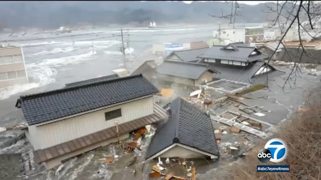
It's been ten years since an undersea earthquake triggered a massive tsunami that plowed into the Japanese coastline. The devastation of the Tohoku-Oki earthquake and tsunami was jaw-dropping. Cars and homes were swept away, a nuclear power plant suffered a meltdown and nearly 16,000 people were killed.
"We're releasing maps with many improvements to keep Californians safe," said Dr. Steve Bohlen, Acting State Geologist of California and head of CGS. "Japan utilized data from several hundred years of tsunami records in its planning, which seemed perfectly reasonable, then was hit by a once-a-millennium tsunami. So, we're using a thousand-year scenario as the baseline for our new maps, hoping to avoid the tragic loss of life experienced there. While damaging tsunamis are infrequent in California, if you're on the coast, you need to be aware of this potential hazard."
Some of the biggest concerns are areas like Marina del Rey and as well the Ports of L.A. and Long Beach
Experts also warn that the timing of a tsunami could spell disaster.
"On summer weekends and holidays, Los Angeles County can have over one million beachgoers per mile length of beach," Graehl said.
Emergency officials are hoping residents won't wait for a major earthquake or tsunami threat to visit the maps, but instead will use them now to put together an escape plan to get them to higher ground.
They also suggest you registered to a local alert system.
"Sign up for emergency alerts like Alert L.A. County," said Lindsay Call of Santa Monica's Emergency Management Department. "So that you can be informed and quickly check for the latest public safety alerts."
The California Geological Survey's website includes valuable emergency information and videos. The online resources are also interactive - all you have to do is enter your home address to see what kind of tsunami hazard you may be facing.
You can find the tsunami maps at https://www.tsunamizone.org/california/.