Grapevine section of 5 Freeway reopens, but incoming storm threatens another shutdown


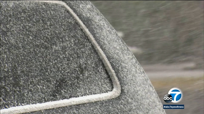
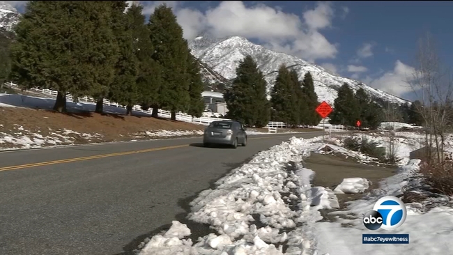
CASTAIC, Calif. (KABC) -- The 5 Freeway was closed through the Grapevine Wednesday morning and didn't reopen until the afternoon due to snow and icy conditions. The closure comes as Southern California is bracing for a major storm -- the latest in a series of systems that have brought rain, snow and even hail to the region over the past few days.
The 5 Freeway was closed northbound at Parker Road in Castaic, and southbound at Grapevine Road in Lebec in Kern County, Caltrans said. Caltrans announced at around 2:30 p.m. that the 5 was reopened in both directions after California Highway Patrol officers escorted some drivers through the Grapevine as conditions improved.
The CHP warned the freeway could be closed off and on for the next few days.
"About 6:30 this morning, we got word...that due to snow and ice that it was necessary to close the I-5 Freeway," said CHP Sgt. KJ Pack. "The next couple of days, just pay attention to the weather reports and be patient and come up with an alternate plan."
While the lanes remain open, Caltrans is warning drivers to distance themselves from other vehicles due to slick roads.
The Grapevine is expected to be shut down Thursday for an unknown duration due to the storm.
The latest storm system is set to sweep in from the north late Wednesday, bringing heavy rain and snow on Thursday and Friday.
Full SoCal forecast: New storm system arrives late Wednesday
A winter storm watch is in effect until Friday at 3 p.m. as this system may bring 2-4 inches of rain to some communities and more than 10 inches of snow to the mountains.
Meanwhile, those living in wildfire burn areas are preparing for flash flooding, mudslides and debris flows.
The Bobcat Fire burn scar in Monrovia is a major concern.
"Under the past rain events since the Bobcat Fire, we've been at a Phase One, which is moderate. At this point, they're not looking at any elevation to that," said Sean Sullivan, public works director. "Looking back to this past December, we haven't seen any mud or debris movements, all of our drainage functions and structures are operating appropriately."
Multiple signs have been posted along Oak Glen Road in Oak Glen, warning residents about possible trouble if the storm is as strong as expected.
"Some of those areas are the ones you see behind us here above the north bench is an area of grave concern," said Cal Fire Captain Bennet Miloy
He adds while all of the snow at lower elevations would typically be a good thing, dangerous conditions could arise if snow-capped foothills are pounded with heavy rain.
WATCH: SoCal burn areas bracing for mudslides, debris flow as major storm approaches
"That snow -- which would normally be good for us, which holds that water in solid form -- as soon as you add warm precipitation to it, or rain, that can accelerate that melting to a very short period of time, especially if you have heavy rain," Miloy said.
He says another concern is the possibility that the bulk of the storm could happen overnight.
"It is a concern because most of our citizens are going to be asleep," Miloy said. "This is a similar pattern to what was present in Montecito during that time period. That's when we had those heavy rains in the middle of the night and people were asleep and not prepared."
RELATED: Snow in Southern California: Storm brings hail, snow to lower elevations