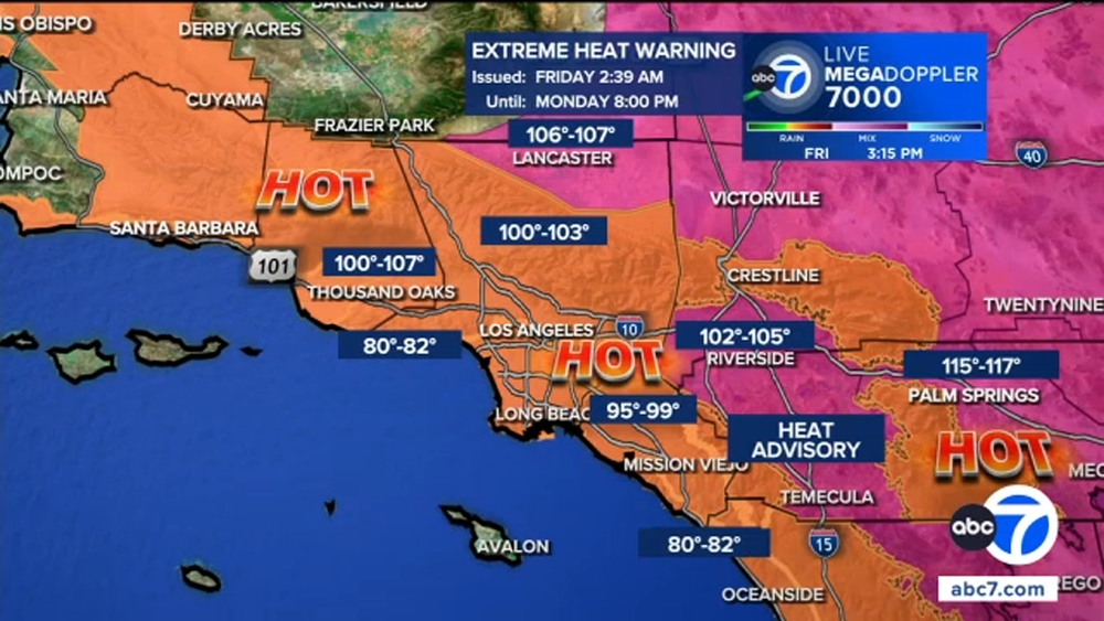
Real-time map shows latest coronavirus cases in Los Angeles County

Wednesday, March 18, 2020

KABC
A map of coronavirus cases in Los Angeles County was created by the Homeland Security Advisory Council and shows the latest updates on the COVID-19 epidemic in Southern California.
See the map below to see the number of cases as well as locations for LAUSD's "Grab and Go" Food Centers.
TIP: If you are viewing the map on a mobile phone, turn your device to landscape for the best experience.
Map credit: HSAC@SPP
Copyright © 2026 KABC Television, LLC. All rights reserved.