Pacific Palisades residents prepare as officials warn of mud and debris flow risk

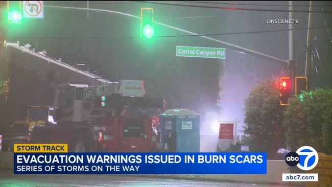
Residents living in and around recent burn scar areas in the Pacific Palisades are preparing for heavy rain expected overnight, with officials urging people to be ready for possible evacuations.
In the Palisades fire zone, a portion of Topanga Canyon Boulevard was closed on Sunday night as the storm approached. City and county officials say the combination of saturated hillsides and firedamaged terrain increases the risk of mud and debris flows.
"We seem to be in nature's spotlight lately," resident Will Adams said as neighbors made storm preparations across the Palisades.
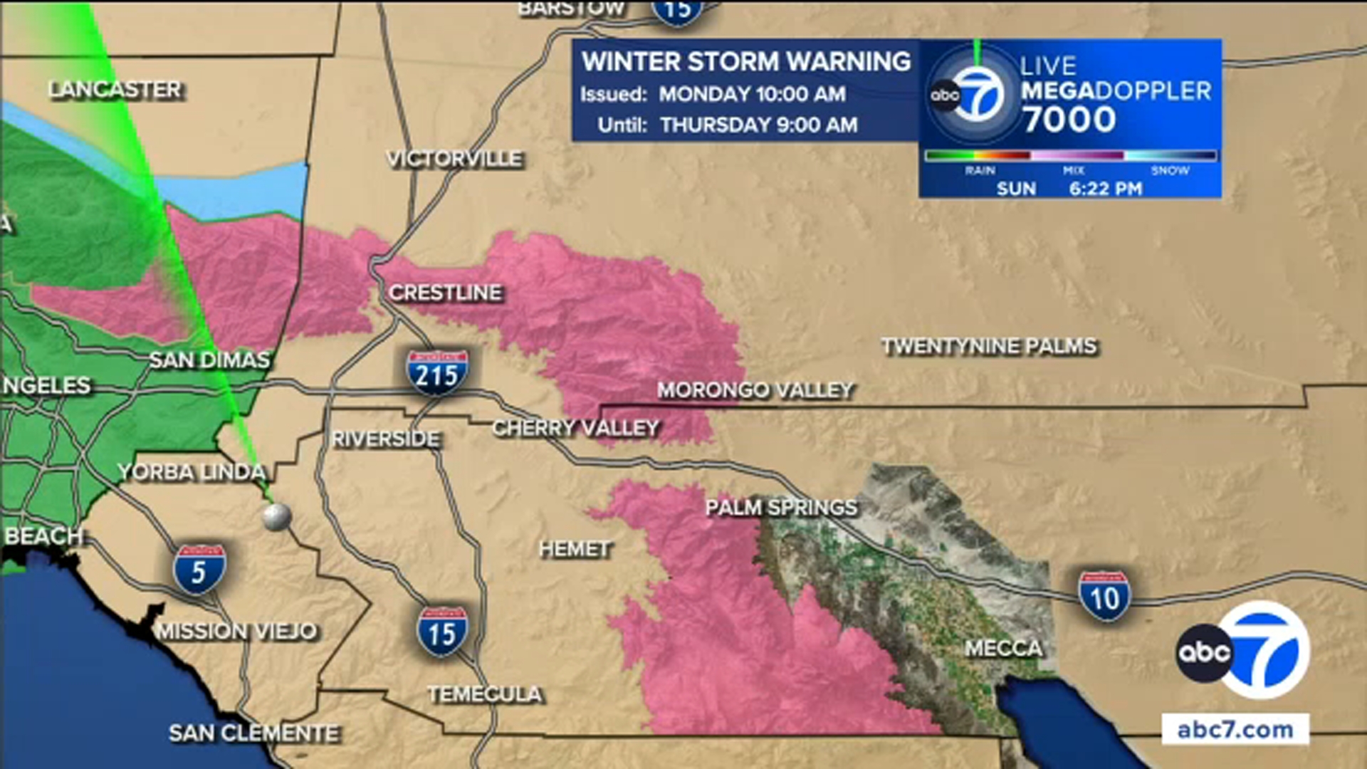
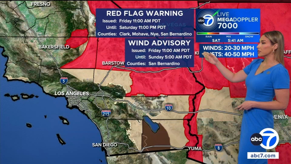
Forecasters warn the incoming system could be the strongest storm of the season, bringing heavy rain, strong winds and a threat of flash flooding. Officials are advising residents to secure outdoor items, gather emergency supplies and prepare for possible power outages.
"Given the fires, I should have a better plan, but I don't," Adams said. "But my wife always has a plan, so I'll rely on her."
Similar preparations were underway in Altadena, where residents near burn scar areas picked up sandbags and stocked up ahead of the storm.
Authorities announced road closures on Topanga Canyon Boulevard due to the risk of mudslides, falling rocks and debris.
"We must kind of make a move or be thoughtful about what kinda rain is coming," a Pacific Palisades resident said. "It's seasonable, so I'm not threatened. I think we're going to get a good soaking and a bit of rain."
The heaviest rainfall is expected on Monday morning and afternoon. Officials are urging people in burn scar areas to stay alert, have an emergency plan and be prepared to leave if evacuation orders are issued.