Live updates: Storm brings flooding, stalled cars near Burbank airport

KABC logo
Last updated: Friday, February 20, 2026 1:04PM GMT
ABC7 Eyewitness News

LOS ANGELES (KABC) -- You may want to keep the rain boots and umbrellas out as the third storm to hit Southern California this week moves into the region Thursday morning, bringing more rain to areas previously affected.

Powerful thunderstorms, wind and rain battered the region just days ago, toppling over trees and leading to water rescues.

Get the latest storm timeline and developments from across the region below:

Brianna Ruffalo  Image
Feb 19, 2026, 8:08 PM

SoCal will soon get a break from wet weather

The third storm of the week is quickly moving into Southern California, bringing more rain and snow, but the region will soon get a break from the wet weather.

Light to moderate rail will continue to move east, with heavy downpours possible at times. Cold temperatures and gusty conditions with potentially damaging winds will remain even after the rain stops.

The widespread rain will begin to taper off by the early afternoon hours as it moves into the Inland Empire.

The third storm of the week is quickly moving into Southern California, bringing more rain and snow, but the region will soon get a break from the wet weather.
Leanne Suter Image
Feb 18, 2026, 3:52 AM GMT

Snow could shut down 5 Freeway through the Grapevine

The California Highway Patrol is warning drivers that up to 3 inches of snow could fall on the Grapevine as a cold winter storm moves into the region, creating potentially dangerous travel conditions.

Traffic on Interstate 5 through the Grapevine remained smooth Tuesday, but officers urged drivers to stay alert.

Authorities are warning drivers that up to 3 inches of snow could fall on the Grapevine as a storm moves into the region, creating potentially dangerous travel conditions.

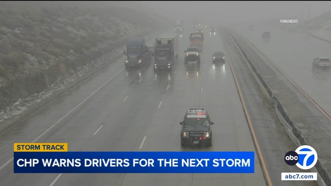
"Once we start getting significant amount of snow on the roadway, obviously it becomes a little bit more dangerous as far as stopping distances and speed. We do get a significant amount of crashes increasing in the area," CHP Officer Carlos Burgos Lopez said.

Officials said snowfall could force a shutdown of the Grapevine or require officers to escort drivers.

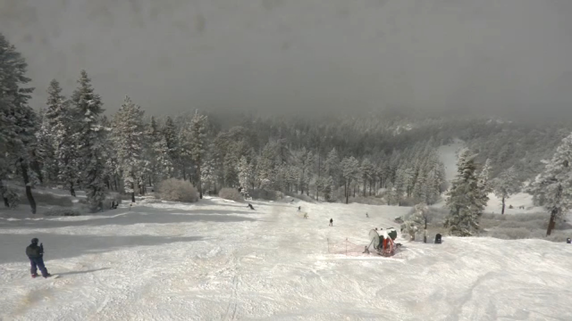
A fresh layer of snow covered the hills above Lebec, and snow levels were expected to fall to 3,000 feet overnight, raising concerns about rapidly worsening conditions.

In addition to snow, light rain and dropping temperatures could create black ice.

Caltrans crews plan to monitor the storm and clear roads as conditions allow.

Sid Garcia Image
Feb 18, 2026, 1:59 AM GMT

Massive tree damages car, part of house in Woodland Hills

In Woodland Hills, the storm is believed to have caused a massive tree to topple, causing some serious damage to a car and part of a house. It also pulled down some power lines, leaving the neighborhood without power.

"It's just crazy that it came right down on this car where there's other spaces where it could have fell," neighbor Haiyan Heydari said.

In Woodland Hills, the storm is believed to have caused a massive tree to topple, causing some serious damage to a car and part of a house.
KABC logo
Feb 18, 2026, 1:18 AM GMT

Big Bear expected to get 30 inches of snow this week

After a winter with little snowfall, communities in the San Bernardino Mountains saw conditions shift as a storm on Monday delivered measurable snow -- with more expected later in the week.

According to Big Bear Mountain Resort, the area is forecasted to get 30 inches of snow this week alone. The storms should clear out by the end of the week, making for a great ski weekend.

Winter storm warnings and alerts remain in effect across the region.

Transportation officials urged caution for anyone planning a mountain trip.

"Chain control is in effect, and these chain requirements levels change. We expect some more weather conditions this week," said Jennifer Ceron with Caltrans District 8.

Caltrans advised drivers to check road and traffic conditions through its QuickMap app before heading into the mountain communities.

KABC logo
Feb 17, 2026, 8:46 PM GMT

LA extends evacuation warnings for burn scar areas

The city of Los Angeles extended the current evacuation warnings for those living near the Palisades, Hurst and Sunset burn areas.

The warnings will remain in place "until further notice," the city said.

This comes as more rain is expected in the next coming days.