Heavy rain moves into SoCal, with showers expected all day Tuesday
A significant amount of rain is in the forecast for Southern California this week, triggering a flash flood watch for much of the region.
With the impending rain, there is concern for the burn scar areas from the January wildfires, especially in and around Altadena. About 1.5 inches of rain are forecasted in the Pacific Palisades, and nearly 3 inches are forecasted in Altadena.
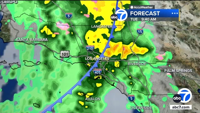
A system moving into the greater Los Angeles area on Monday night is expected to bring a total of 1.5 to 3 inches of rain by Wednesday morning.
By 10 or 11 p.m. Monday, areas north of Los Angeles County will see the rain first. Then, overnight and into the morning hours, expect widespread, heavier rain throughout the area, with stronger showers in the Eaton Fire burn scar areas between 5 and 10 a.m.
Light to moderate rain will stick around all day on Tuesday. The system also brings the possibility of thunderstorms, hail and strong rotating winds, meaning we could see some tornadic activity on Tuesday.
Overnight into Wednesday, the showers should calm down, with the last of the rain moving east by Wednesday morning.