Nov 14, 2025, 5:01 PM GMT
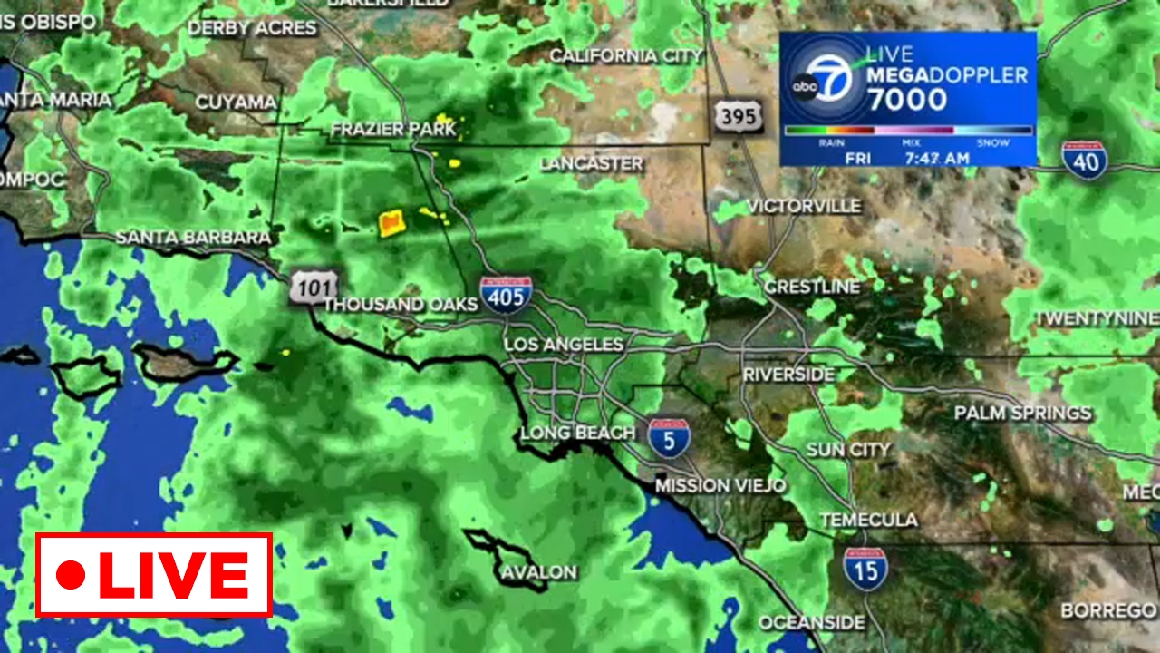
WATCH LIVE: Track the rain with Megadoppler 7000
A storm is rolling across Southern California, soaking the region with rain for several days.
WATCH LIVE | Track the rain with our LIVE Megadoppler 7000

Efforts are underway across Southern California to clean up downed trees, flooding and rockslides after days of rain, and the rush is on to get it all done before the next storm moves in.
Conditions will dry up somewhat for the next few days, but more rain is on the way to the region this week.
A chance for spotty, light showers will stick around Tuesday morning and afternoon.
Wednesday is expected to be mostly dry before another system arrives and brings even more showers between Thursday and Friday.
Forecasters said that system could drop another quarter to three-quarters of an inch of rain.
Here's everything you need to know about the stormy weather this week:
A storm is rolling across Southern California, soaking the region with rain for several days.
WATCH LIVE | Track the rain with our LIVE Megadoppler 7000

The worst of back-to-back-to-back storms has yet to arrive, but drivers across Southern California were already seeing slick roads and tricky driving conditions Friday morning.
Morning commuters encountered some trouble spots on roads across the region, including a big rig crash on the southbound 710 Freeway in the Compton area.
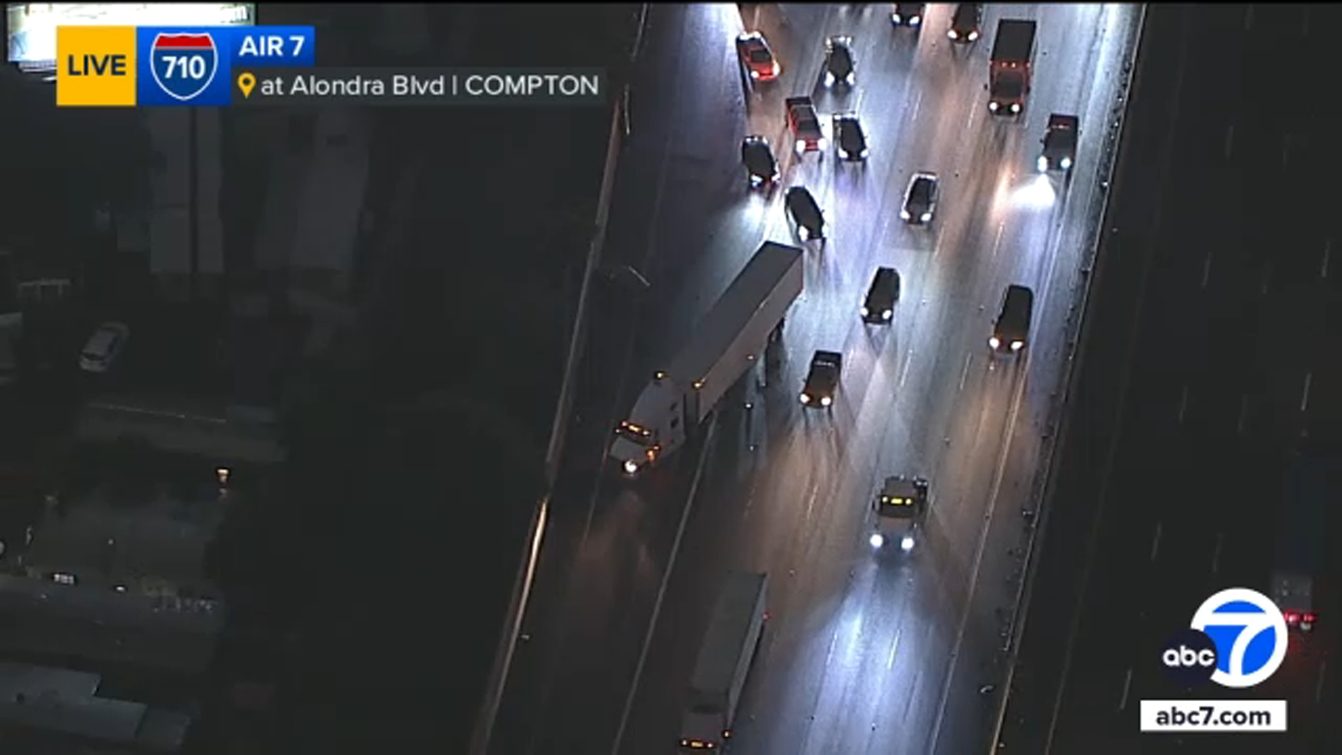
Experts warn that driving conditions are expected to get worse through the weekend.
"If you see a large puddle in front of you... do not drive through it," said Alec Pereyda with the California Highway Patrol. "It's better to be safe than sorry. Turn around if you can. You never know what's inside of that water, how deep it may be. You may become stuck, you may damage your vehicle."
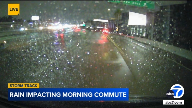
As a reminder: Roads are most slick when it first starts to rain and oil, grease and debris comes up to the surface, which can reduce tire traction.
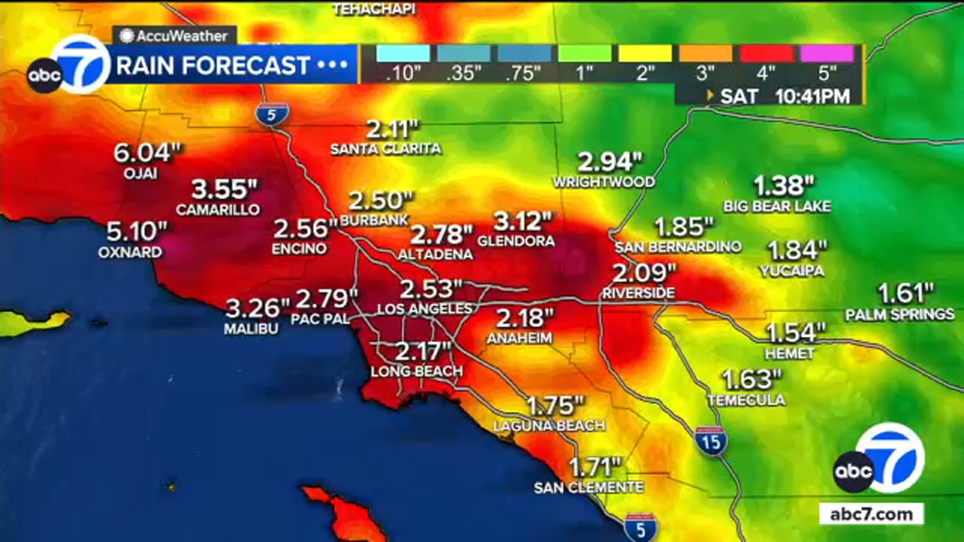
The greater Los Angeles area could likely see more than a normal November months' worth of rain within a 24 hour period with this storm.
Rainfall totals between now and Saturday evening are projected to be 4-inches but areas with the heaviest storms could see more than that.
On average, the L.A. area records 0.8 inches of rain in the entire month of November, meaning this storm will likely bring more than that. The record for this month in 1965 was 9.68 inches.
Here's a look at expected rainfall totals:
More than 22 million people in Southern California are under a flood watch through at least Saturday evening as a storm will bring several rounds of significant rain to the region.
The storm is expected to last through the weekend, elevating the risk for flash flooding, mudslides and debris flows.
Because of that, evacuation warnings are in place for several areas of Southern California.
The greatest risk in burn scar areas will be between 8 p.m. Friday and 3 p.m. Saturday when the the heaviest rain is expected. Rainfall rates could reach 1 inch per hour or great, especially during any thunderstorms.