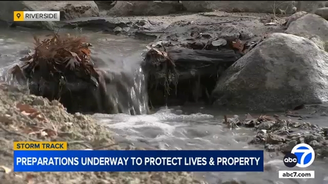
Crews in Riverside are working swiftly to clear the area near the Santa Ana riverbed and help people find shelter in higher ground ahead of the storm.
"They're anticipating the water level to maybe hit around 7 feet, but once it gets 10 feet or over, that's when our fire department and the county fire are going to have to start doing some rescues," said Ryan Railsback, the public information officer for the Riverside Police Department.
"It's unnecessarily putting yourself in danger, but it's also putting our first responders, our firefighters, at high risk."
Crews in Riverside are working swiftly to clear the area near the Santa Ana riverbed and help people find shelter in higher ground ahead of the storm.
People who live in Riverside who spoke with Eyewitness News on Thursday said they're grateful that crews are staying on top of preparations, but some have their own concerns.
"We need rain, but I'm afraid that the side of my house is going to get flooded because the drain pipe is broken, so I had to fix that today," said resident Randi Walsath.
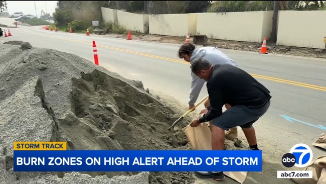
In San Bernardino, residents have been filling up sandbags at Wildwood Park, making preparations before the storm moves in.
Meantime, crews continue to clear out drains and culverts in the El Dorado Fire burn scar area to hopefully avoid the large scale mudslides seen during a storm two months ago.
When it comes to the burn scar areas, county officials are going to be closely monitoring what they call "the thresholds," meaning they're looking at the maximum hourly rate of rainfall that could hit those areas.
They said when it comes to the Bridge Fire that burned in the Mount Baldy area in September 2024, they are approaching those thresholds.
When it comes to the Line, Highland, and El Dorado burn scars in Forest Falls and Oak Glen, they're not sure yet.