SoCal storm brings rain, snow and cooler temperatures; Grapevine remains open with CHP escort


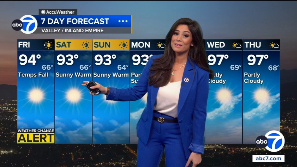
LOS ANGELES (KABC) -- Periodic rain showers and thunderstorms, which began overnight, are expected to continue throughout the day and into the evening along with colder temperatures and a snow level as low as 2,500 feet, according to the National Weather Service.
Video from overnight off the 14 Freeway in Acton showed a steady flow of snow coming down.
A snow advisory has been issued for the Grapevine. The California Highway Patrol is escorting drivers between Fort Tejon and the 138 Freeway.
The 5 Freeway remains open at this time.
For those planning to travel to the Lake Tahoe area this weekend, heavy snow and strong winds are expected in the Sierra Nevada.
The National Weather Service says that some areas could see 12 to 24 inches of snow. Big Bear and the Wrightwood area are expecting to see up to 3 inches on Friday.
A winter storm warning will be in effect until 11 p.m. Friday in the San Gabriel Mountains and the Antelope Valley--14 Freeway corridor, with forecasters predicting possible accumulations of 10 inches of snow above 6,000 feet, 3 to 6 inches as low as 5,000 feet and 3 inches at 3,000 feet -- all accompanied by winds gusting up to 45 mph.
A less severe winter weather advisory will be in effect until 11 p.m. Friday for the Antelope Valley foothills and the 5 Freeway corridor.
Due to the perilous conditions, authorities strongly discourage travel on Friday.
City News Service Inc. contributed to this report.