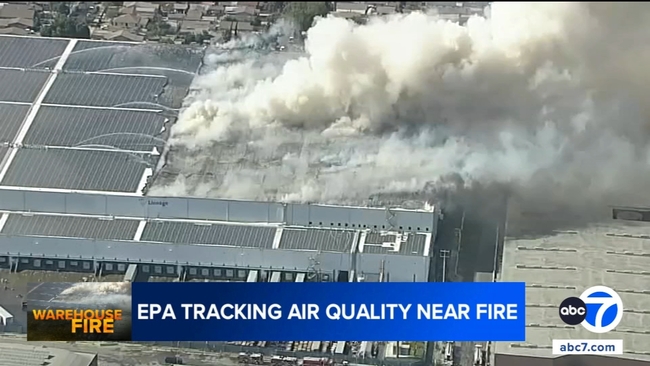

Pollution levels spike near Boyle Heights fire. How to check air quality on sensors closest to you
A temporary air sensor placed just a few blocks east of the cold storage facility fire in Boyle Heights recorded a dramatic spike in pollution levels overnight, according to real time data from the EPA's AirNow map.
The map, which pulls readings from thousands of sensors across the region, showed the temporary monitor listing moderate air quality on Tuesday. But hourly data revealed that at 9 p.m. Monday, the Air Quality Index surged to 621 - a level far above the 300 mark, which anything above is considered "hazardous".
By Tuesday, the AQI at that same sensor had dropped back to 66, underscoring how quickly readings can shift depending on wind patterns.
Doctors say the AQI number is critical for anyone near wildfire smoke.
Residents can check the AQI from the sensor closest to them at the AirNow Fire and Smoke Map website.
FULL STORY HERE.