Live updates: Storm brings flooding, stalled cars near Burbank airport

KABC logo
Last updated: Friday, February 20, 2026 1:04PM GMT
ABC7 Eyewitness News

LOS ANGELES (KABC) -- You may want to keep the rain boots and umbrellas out as the third storm to hit Southern California this week moves into the region Thursday morning, bringing more rain to areas previously affected.

Powerful thunderstorms, wind and rain battered the region just days ago, toppling over trees and leading to water rescues.

Get the latest storm timeline and developments from across the region below:

Brianna Ruffalo  Image
Feb 19, 2026, 8:08 PM

SoCal will soon get a break from wet weather

The third storm of the week is quickly moving into Southern California, bringing more rain and snow, but the region will soon get a break from the wet weather.

Light to moderate rail will continue to move east, with heavy downpours possible at times. Cold temperatures and gusty conditions with potentially damaging winds will remain even after the rain stops.

The widespread rain will begin to taper off by the early afternoon hours as it moves into the Inland Empire.

The third storm of the week is quickly moving into Southern California, bringing more rain and snow, but the region will soon get a break from the wet weather.
Rob Hayes Image
Feb 20, 2026, 12:44 AM GMT

Drivers get stuck on flooded street near Burbank airport

Stormy weather on Thursday brought flooding and traffic problems across parts of Los Angeles, including near Hollywood Burbank Airport, where some drivers became stranded in rising water.

Stormy weather on Thursday brought flooding and traffic problems across parts of Los Angeles, including near Hollywood Burbank Airport, where some drivers became stranded in rising water.

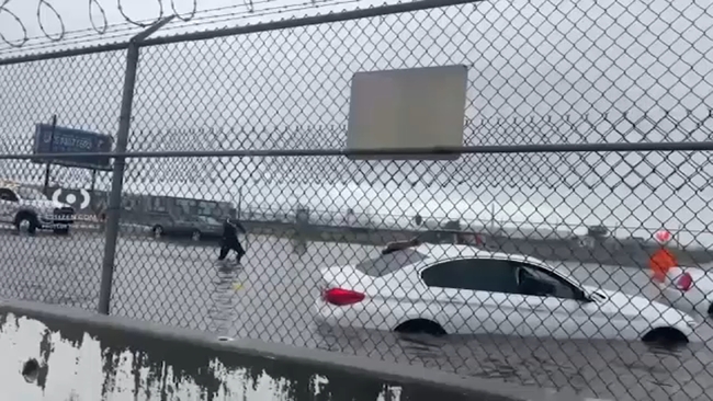
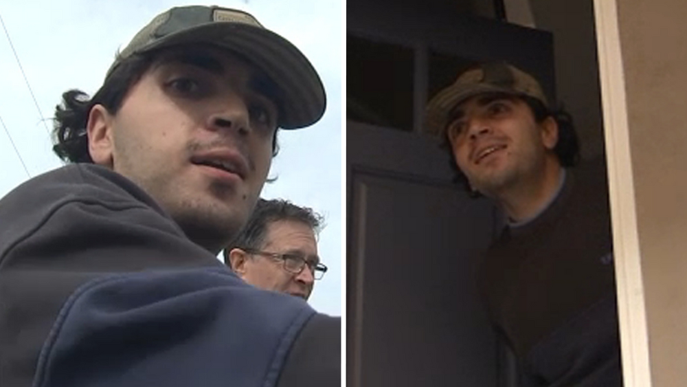
Richard Gesswein spoke with Eyewitness News and said he got stuck while driving through a flooded area near Vanowen Street and Vineland Avenue and had to leave his vehicle before help could arrive.

"They wouldn't tow me unless I got out of the car," he said. "So I walked through a bunch of water and, I'll tell you, all the service stuff is really amazing, but I guess there'll be a tow truck here pretty quickly."

Several other vehicles also stalled in high water near Vineland Avenue and in other parts of the San Fernando Valley as the storm moved through.

While conditions were less dramatic elsewhere, steady rainfall left many residents navigating puddles, umbrellas and sporadic street flooding.

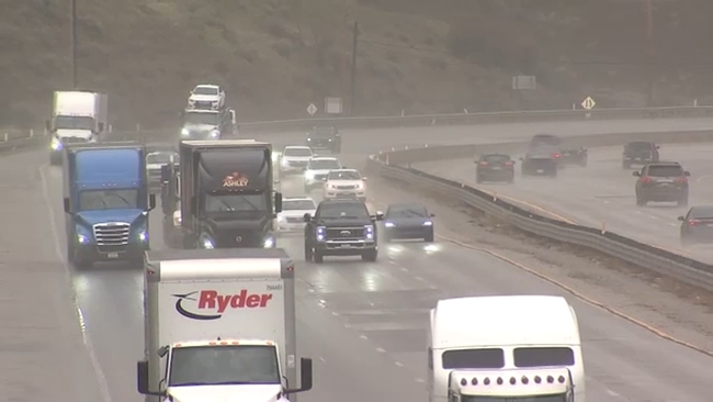
By late afternoon, traffic was flowing smoothly on the 5 Freeway and skies had cleared, though winds persisted.

The Valley remained under a wind advisory until 9 p.m.

Leo Stallworth Image
Feb 19, 2026, 11:28 PM GMT

Driving conditions steady on 5 Fwy through the Grapevine, but that could change

A third winter storm moving across Southern California could make driving through the Grapevine increasingly dangerous, but so far, things haven't been so bad.

The northbound 5 Freeway has faced closures and delays throughout the week due to wintry conditions, and more disruptions are possible Thursday night.

A third winter storm moving across Southern California could make driving through the Grapevine increasingly dangerous, but so far, things haven't been so bad.

We drove down the freeway - just a few miles out of Castaic toward Frazier Park - and there were relatively manageable conditions as the storm approached.

A winter storm warning remains in effect through Friday morning, with up to four inches of snow possible near the pass.

Drivers can expect rain mixed with snow at times, plus gusty winds strong enough that officials are urging those pulling trailers or driving campers to avoid the area.

With temperatures expected to drop below freezing, slush and black ice could make the roadway especially hazardous.

"I'm a Frazier Park resident so I'm a little familiar with the weather conditions," said one driver. "Just take it slow, and if it's too dangerous, don't be on the road."

Some drivers traveling near Frazier Park watched snow gather on the surrounding mountains, wondering whether the snowline might drop and force another freeway closure.

"They sometimes close the 5 freeway when it snows or when you know it freezes," another driver said.

Caltrans has advised travelers to check conditions before heading out and to prepare for possible closures or chain requirements as the storm continues.

Rob McMillan Image
Feb 19, 2026, 10:38 PM GMT

Rain, wind slam the IE, from Cajon Pass to Lake Arrowhead

A powerful burst of rain and wind swept through the Inland Empire on Thursday, creating dangerous driving conditions in the Cajon Pass and surrounding mountain communities.

Temperatures hovered around 37 degrees Thursday morning and wind gusts remained strong.

Video captured earlier in the day showed heavy traffic along the 15 Freeway even before the rain arrived.

A semitruck slid off the road, prompting Caltrans crews and emergency workers to pull it back onto the freeway. Though the crash was not weatherrelated, it contributed to slowdowns that worsened once the storm moved in around 9 to 10 a.m.

Winddriven rain reduced visibility, blowing horizontally across the freeway. Several drivers from out of the area said the conditions required extra caution.

"Slow down. Give some space," one driver said. Another added, "It's difficult with all the rain. We come from a rural area, so we're not used to this, but if I pay attention, I do okay."

In Lake Arrowhead, there was snow in lower elevations. Strong winds in the mountains toppled a large tree onto a home, leaving it uninhabitable.

A powerful burst of rain and wind swept through the Inland Empire on Thursday, creating dangerous driving conditions in the Cajon Pass and surrounding mountain communities.

Forecasts indicated the storm would move out quickly.

Brianna Ruffalo  Image
Feb 19, 2026, 8:08 PM GMT

SoCal will soon get a break from wet weather

The third storm of the week is quickly moving into Southern California, bringing more rain and snow, but the region will soon get a break from the wet weather.

Light to moderate rail will continue to move east, with heavy downpours possible at times. Cold temperatures and gusty conditions with potentially damaging winds will remain even after the rain stops.

The widespread rain will begin to taper off by the early afternoon hours as it moves into the Inland Empire.

The third storm of the week is quickly moving into Southern California, bringing more rain and snow, but the region will soon get a break from the wet weather.