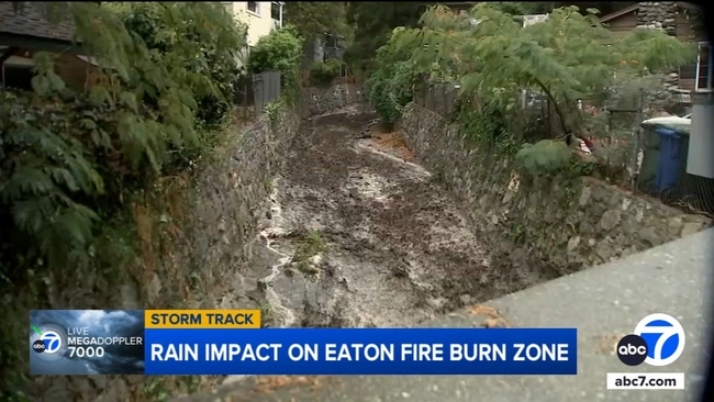
A look at the rain impact on Eaton Fire burn zone
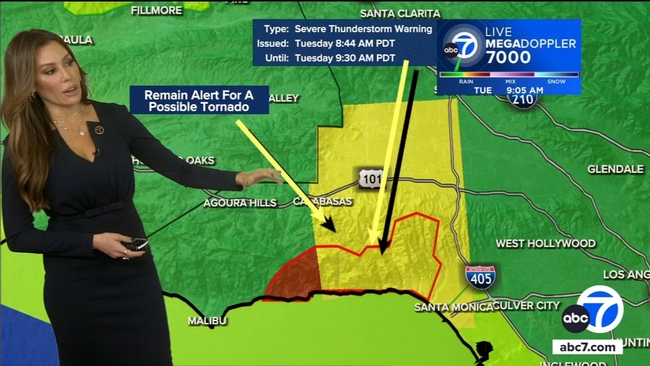
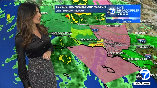
Residents and city officials in Sierra Madre remained on alert Tuesday morning as a strong storm passed through the area, dumping heavy rain at times.
The city was under an evacuation warning due to the potential of damaging mudslides and debris flows during the storm.
Video shows a steady flow of water at the Sierra Madre Canyon Wash, but it did not look deep enough to pose a risk to nearby homes.
Laura Aguilar, with the city of Sierra Madre, said they were still encouraging residents to exercise caution.
"There have been some significant rainfalls overnight that created some mud and debris flows in our canyon areas.. Those are the areas that are mostly impacted by the burn scar from the Eaton Fire that burned our hillsides earlier this year. So we've asked the residents to evacuate or shelter in place."