Tornado warning briefly issued in Ventura County; storm triggers evac order for part of Port Hueneme


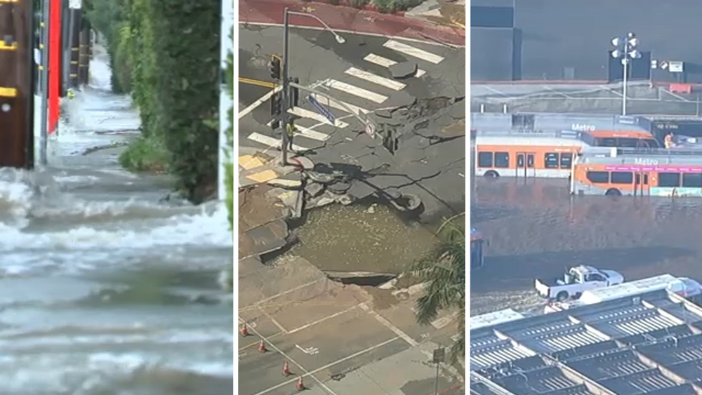
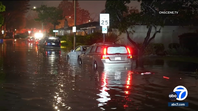
VENTURA, Calif. (KABC) -- A powerful storm brought flash flooding overnight Wednesday in the Ventura and Oxnard areas, briefly triggered a tornado warning for parts of Ventura County, and led to an evacuation order for part of Port Hueneme.
The order was issued at 6 a.m. Thursday due to heavy rain and flooding that was affecting homes in the area of the Hueneme Bay Club, officials said. Firefighter-paramedics responded to at least three separate medical emergencies at the senior-living community, where floodwaters rose as high as 3 feet.
Nancy Bemis, who moved into her apartment at the Hueneme Bay Club on Wednesday, said she and her boyfriend awoke to find their home flooded to knee-high level.
"Everything is destroyed," Bemis told ABC7. "The flooring -- there's no floor left. My furniture -- I might be able to take my bed but that's probably it."
An emergency evacuation shelter was established at the Oxnard College Gymnasium located at 4000 South Rose Avenue in Oxnard. Residents who require assistance with transportation to the shelter can gather at the Hueneme Bay Clubhouse and transportation will be provided, officials said.
At least 60 homes in the Port Hueneme area have been impacted, and city and county officials are working to see if any of them need to be red- or yellow-tagged.
Port Hueneme resident James Holder said he and his wife remained on the second floor of their home amid major flooding downstairs. Both of their cars were damaged by the floodwaters, along with their home's flooring and furniture.
"She lost a box of pictures over here in her personal stuff, and some stuff out in the laundry room too," Holder said. "But you can't replace those kinds of things."
Meanwhile, Holly Donohue, a 20-year resident of Port Hueneme, said she's never experienced anything like this before.
"Going to the bathroom and stepping in gushy water ... carpet's wet, our kitchen floor is flooded, the patio was a mess," she said. "You can't even drive your cars because they're flooded."
Although the water receded Thursday afternoon, the rain continued with more moisture expected at night. At one point, the rainfall was so powerful; it pushed some vehicles up onto the curb. Garage doors busted and much of what was inside is now a complete loss.
"It was just a significant amount of rain," said Port Hueneme City Manager James Vega. "More rain than we had expected, than had been forecasted. We did prepare. We had our crews out prior to this. We were preparing for it, but I don't know that any amount of preparation would have prepared us for this amount of rain. We heard as much as three inches of rain in an hour, which is something that is not typical."
The National Weather Service issued the tornado warning shortly before 1:30 a.m. for areas north of Oxnard including El Rio, Saticoy and Montalvo, "due to a high-intensity rain and thunderstorm cell." It expired an hour later.
"No tornado activity has been observed at this time," the Ventura County Sheriff's Office reported before 2 a.m.
The Weather Service issued its second-highest flood threat forecast for Santa Barbara and Ventura counties, which are the bull's-eye of the storm, the second one to pass through Southern California this week. The agency warned that winds could knock down tree limbs and blow around objects that aren't secured.
"Please stay off the roadways for the next several hours," the Oxnard Fire Department said on social media. "Significant flooding issues across Oxnard and Port Hueneme. Vehicles are getting stuck in the roadways." Emergency personnel and vehicles were seen responding to calls throughout the area. No injuries were reported.
WATCH | Oxnard Civic Center gets just over 3 inches of rain in 1 hour, NWS says
Local residents and authorities this week have been preparing for the possibility of flooding in areas that have been damaged in the past.
The CHP was warning drivers to be careful on the 101 Freeway. Flooding is possible in sections of roadway where the water settles, which has happened in the past in Montecito. On Wednesday, ABC7 witnessed multiple small fender benders on the freeway.
Port Hueneme evacuations
The evacuation order in Port Hueneme was issued for the area north to Bolker Way, south to Channel Islands Boulevard, west to Patterson Road and east to Triton Street.
An evacuation warning was in effect for the area north to West Hemlock Street, south to Bolker Way, west to Patterson Road and east to Trion Street.
No estimate was given indicating when the order and warning would be lifted.