

AccuWeather


- Winter Weather Advisory
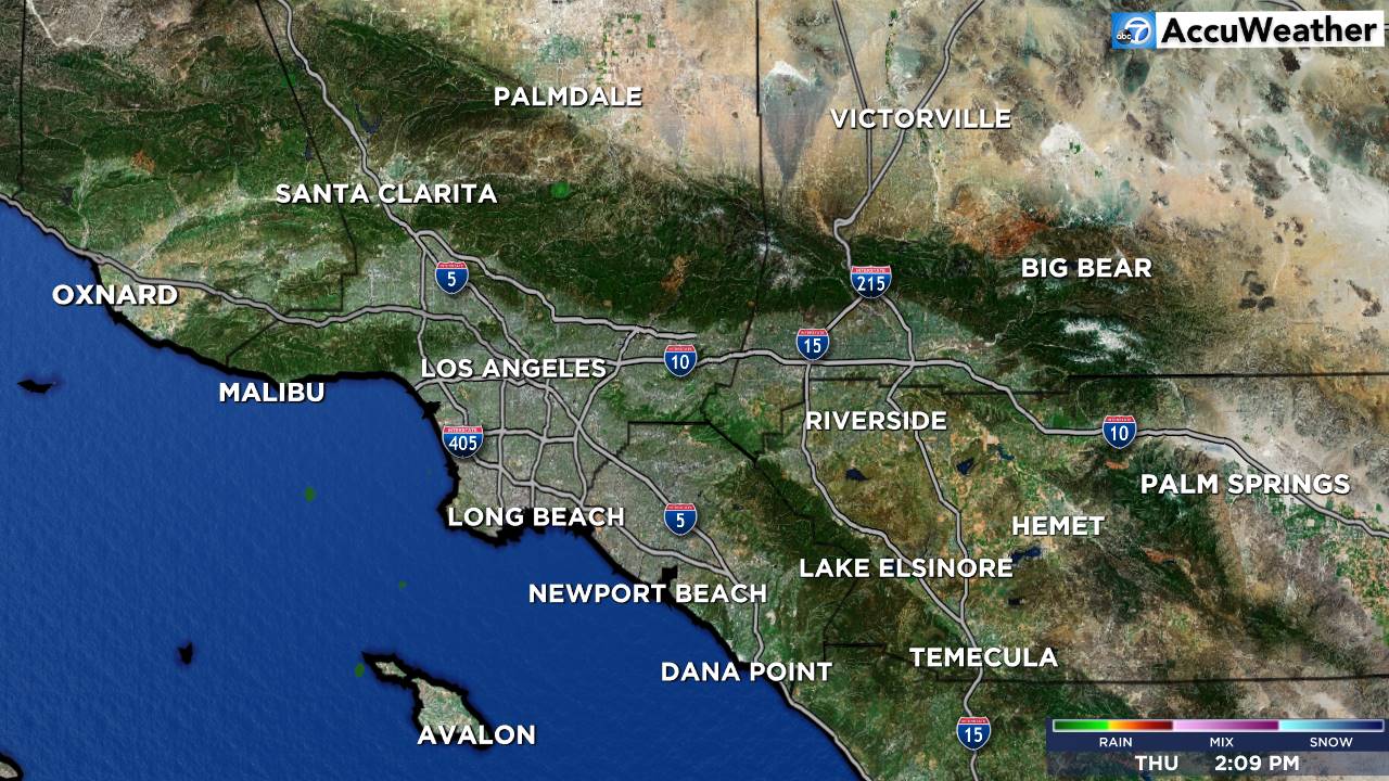
* WHAT...Periods of snow expected. Accumulations of a dusting to 2 inches. Wind gusts up to 35 mph. * WHERE...Antelope Valley. * WHEN...From 10 PM this evening to 2 PM PST Monday. * IMPACTS...The hazardous conditions could affect the Monday morning commute.More
- Winter Weather Advisory
* WHAT...Periods of snow expected. Total snow accumulations of 2 to 4 inches. Wind gusts up to 35 mph. Snow levels 3000 feet, but occasionally to 2500 feet in heavier showers. * WHERE...Eastern Antelope Valley Foothills and Western Antelope Valley Foothills. * WHEN...From 10 PM this evening to 2 PM PST Monday. * IMPACTS...The hazardous conditions could affect the Monday morning commute.More
- Winter Weather Advisory
* WHAT...Periods of snow. Snow accumulations 4 to 8 inches, locally up to one foot. Wind gusts up to 45 mph. Snow levels around 4000 feet today, lowering to 3000 feet tonight and Monday. Light snow accumulations are possible on Interstate 5 around the Grapevine. * WHERE...Interstate 5 Corridor, Northern Ventura County Mountains, Santa Barbara County Interior Mountains, Southern Ventura County Mountains, and Western San Gabriel Mountains and Highway 14 Corridor. * WHEN...Until 4 PM PST Monday. * IMPACTS...Travel could be very difficult. The hazardous conditions could impact the Monday morning commute.More
- Winter Storm Warning
* WHAT...Heavy snow expected. Total snow accumulations up to 14 inches. Wind gusts up to 50 mph. Snow levels around 4000 feet through this evening, then down to 3000 feet tonight and Monday. * WHERE...Eastern San Gabriel Mountains. * WHEN...Until 4 PM PST Monday. * IMPACTS...Travel could be very difficult to impossible. The hazardous conditions could affect the Monday morning commute.More
- Flood Watch
* WHAT...Flash flooding and debris flows caused by excessive rainfall are possible in and near the burn scars. * WHERE...The Eaton, Palisades, Franklin, Bridge, and Hughes burn scars. * WHEN...From 10 AM Sunday morning through 4 PM Monday afternoon. The highest risk for debris flows would be after 4 PM Sunday. * IMPACTS...Heavy rain over the burn scars could trigger debris flows. * ADDITIONAL DETAILS... - Rain rates may exceed USGS thresholds for debris flows from late Sunday morning into Monday. There is a slight chance of thunderstorms during this time. - http://www.weather.gov/safety/floodMore


